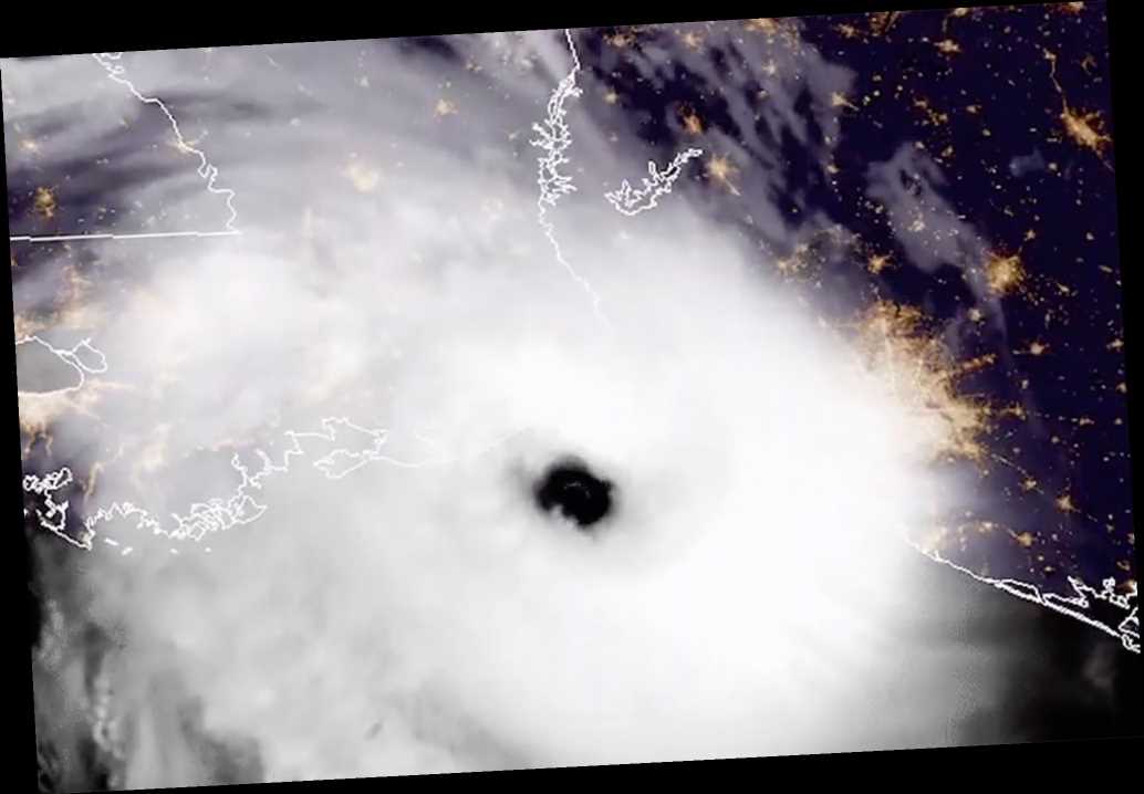
This is the moment Hurricane Laura slammed into southwest Louisiana early Thursday as a Category 4 monster — packing maximum sustained winds of 150 mph, a satellite image shows.
GOES-16 — which stands for Geostationary Operational Environmental Satellite, operated by NASA and the National Oceanic and Atmospheric Administration – captured the spiraling behemoth’s eye making landfall at 1 a.m. local time near near Cameron, about 30 miles east of Texas.
It is the most powerful hurricane to strike the US so far this year.
A few hours later, the National Hurricane Center said Laura weakened to a Category 2 hurricane as it moved deeper inland over Louisiana with maximum sustained winds of 110 mph.
Forecasters say it was centered about 45 miles north-northwest of Lake Charles and moving north at 15 mph.
Share this article:
Source: Read Full Article