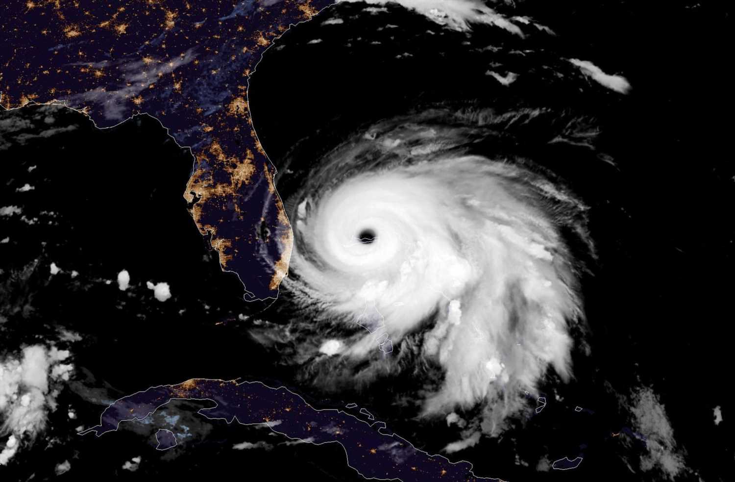
HURRICANE Dorian is now the second strongest Atlantic storm in history as the 225mph killer edges towards Florida.
The category 5 monster made landfall in the Bahamas with devastating force on Sunday, reportedly killing a seven-year-old boy.

More deaths are feared from the mega-storm – which is now officially the most powerful ever recorded in the Atlantic, bar one.
On Sunday, Dorian's maximum sustained winds reached 185 mph, with gusts up to 225mph – tying the record for the most powerful Atlantic hurricane to ever make landfall.
That equalled the Labour Day hurricane of 1935, before storms were even named.
The only recorded storm that was more powerful was Hurricane Allen in 1980 – which had sustained 190mph winds but didn't make landfall at that strength.
Darren Henfield, Bahamian Minister of Foreign Affairs said: “From all accounts, we have received catastrophic damage.
“We have reports of casualties. We have reports of bodies being seen.
“We cannot confirm those reports until we go out and see for ourselves.”


But the people of the Caribbean nation received no respite today as the storm continued to pummel the islands after slowing to almost a complete stop.
Deadly Dorian hovered over the country, shredding roofs, hurling cars and forcing rescue crews to halt their searches to seek cover.
The system crawled along Grand Bahama Island at just 1mph, as it creeps towards the US mainland.
Kwasi Thompson, minister of state for Grand Bahama, warned locals: “We need you to bunker down.
“It's going to be another 10-12 hours that we're going to be bombarded with this.”
Officials revealed they were getting desperate calls for help but rescuers can’t go out themselves in the violent weather.
Thompson said: “They are ready to get into those areas as soon as the weather subsides.”
As many as 13,000 homes have been severely damaged or destroyed, according to a statement from the Red Cross.


The storm is now heading straight for Florida, sparking fears for thousands of holidaymakers.
Dorian is due to strike Orlando on Wednesday morning and skirt up the Florida coast, according to current predictions.
Most theme parks there including Disney were this weekend still operating normally, but are monitoring the storm's path.
Around 1.5million people have been evacuated from South Carolina, Georgia and Florida as the monster storm approaches.
Residents were pictured stocking up on emergency supplies like food, water and batteries, while others boarded up homes and businesses to protect them as best they could.
More than 1,000 flights within, into, or out of the US have also been cancelled today, according to the aviation tracking website FlightAware.
As Dorian bears down, pilots from the US Air Force have taken incredible photos of the eerily calm conditions inside the eye of the hurricane.
One image shows a phenomenon known as the “stadium effect” in the centre of the storm, which makes the clouds around the eye rise up on all sides until it looks like a giant sports arena.
Winds in the wall of clouds closest to the middle are the strongest – at a massive 225mph in the case of category 5 Dorian.
But in the centre the sky above is clear and the air is eerily still, creating the illusion that the storm has passed.


Source: Read Full Article