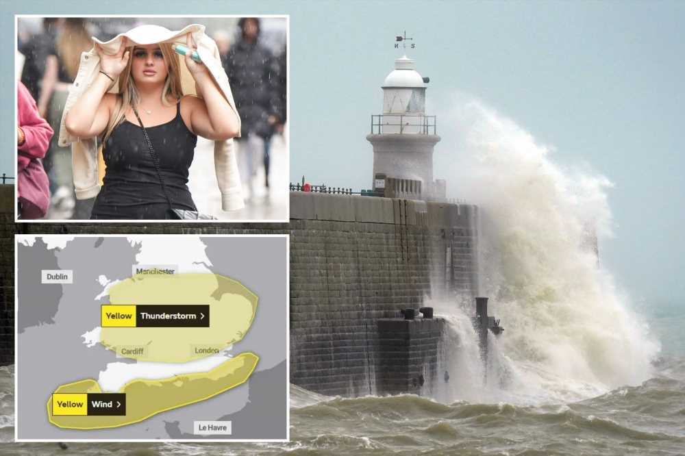
BRITS are facing travel chaos and power cuts TOMORROW as Yellow weather warnings are rolled out across the country.
Gales will batter the entire length of the South Coast of England – threatening to knock out power lines, trees, temporary structures and even topple lorries.


The wind warning is in place from 4am – 6pm on Wednesday.
And a second Yellow warning for thunderstorms will stretch from London to West Wales and up to Manchester across the M62 corridor to Hull.
This is in place from 9am to 7pm on Wednesday.
Delays are now expected on road, rail, bus, air and ferry networks – threatening to spark travel carnage across the country.
Read More weather stories

Sunshine to return today as UK summer is ruined by heavy rain & winds

Unusual weather means your house could be invaded with poisonous spiders
It is a second blow to train commuters currently navigating strike hell from drivers' union ASLEF until Saturday.
The Met Office said: "There will probably be some damage to a few buildings and structures from lightning strikes.
"Delays to train services are possible. Some short term loss of power and other services is likely."
The weather watchers are advising drivers to wait until downpours clear before hitting the road on Wednesday.
Most read in The Sun

Love Island voting numbersrevealed as Jess & Sammy win amid 'fix' claims

Agony for Towie star Clelia Theodorou as mum dies in car crash

Pee-wee Herman star dies at 70 after private cancer battle

Four tourists found dead after car breaks down in middle of 'Sea of Death'
Surface water can cause you to lose control of a vehicle and heavy rain impacts visibility through spray.
There are not currently any flood warnings in place.
The warnings come as Tuesday got off to a mild start – with highs of 22C in London, 19C in Birmingham and 19C in Edinburgh forecast later today.
But variable cloud and light showers are expected in South East Scotland, North East and North West England towards midday.
These could merge into longer spells of rain at times and turn heavy in some areas and it is expected to turn wet and windy in the far south-west in this afternoon and into the evening.
Over this evening and overnight, outbreaks of showery rain will spread northwards across the UK being heavy and thundery in places.
WEDNESDAY WEATHER WARNINGS
What to expect
- Delays for high-sided vehicles on exposed routes and bridges likely
- It’s likely that some coastal routes, sea fronts and coastal communities will be affected by spray and/or large waves
- Some delays to road, rail, air and ferry transport are likely
- Probably some bus and train services affected, with some journeys taking longer
- Some short term loss of power and other services is possible
- Trees and temporary structures such as marquees and tents may be damaged
Source: Met Office


Source: Read Full Article