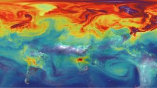
German manufacturer OHB-System has signed a €445m (£400m) contract to begin construction of a satellite network to monitor carbon dioxide.
The CO2M constellation will consist in the first instance of two spacecraft, but there is an option for a third.
The platforms will track the greenhouse gas across the globe, helping nations assess the scale of their emissions.
Under the Paris climate accord, countries must compile CO2 inventories. CO2M will provide supporting data.
The aim is to launch the OHB spacecraft in 2025 so they can inform the international stocktake that will report in 2028.
- UK industry loses out in European satellite bids
- Europe’s new space budget to enable CO2 mapping
- Antarctica’s ‘green snow’ mapped from space
CO2M falls under the European Union’s Copernicus Earth observation programme. This flies a series of satellite sensors called Sentinels, which monitor everything from damage wrought by earthquakes to the health of staple food crops.
When the CO2M spacecraft go into orbit, they too will assume the Sentinel moniker.
No-one draws a distinction between the importance of the different Sentinels but given the urgency of the climate crisis, “CO2M will be the beacon of Copernicus, its most visible mission”, Marco Fuchs, the CEO of OHB-System, told BBC News.
His company’s contract is with the European Space Agency (Esa), which acts as the technical and procurement agent for the EU on Copernicus.
The requirement is that CO2M track carbon dioxide in the atmosphere at a resolution of 2km by 2km across a minimum swath of 250km.
The satellites will carry a CO2 instrument, obviously, but a range of secondary sensors also to help with the signal’s retrieval and to differentiate the human-produced sources of the gas from those emitted by natural processes.
Franco-Italian manufacturer Thales Alenia Space has been engaged as a key sub-contractor. Its French division will deliver a combined carbon dioxide and nitrogen dioxide spectrometer that operates in near- and shortwave-infrared bands.
TAS’s UK arm will build a multi-angle polarimeter; and the Belgian company OIP Sensors will make a cloud imager.
Mr Fuchs said the demands of the Paris Agreement were driving the ambition to get the satellites up in five years’ time: “But obviously some of the optics are very new and very sensitive, so we will have to monitor how they progress. But, certainly, the commitment we have is to launch the satellites from 2025 onwards.”
There are currently six Sentinel satellite systems either already in orbit, or soon to be in orbit. CO2M is part of an expansion that would see the Copernicus space component double in size.
How soon this advance in capability can be achieved is uncertain, however.
The leaders of the EU’s 27 member states recently agreed a downgrading of the proposed Copernicus budget in the next financial period (2021-2027) from €5.8bn to €4.8bn.
If this budget envelope is implemented, it will impact the roll-out of the expansion Sentinels.
Indeed, the fact that OHB is only being asked to build two spacecraft for the moment – and not all three – is a reflection of the current financial realities.
The €4.8bn does not include monies that may come from three non-EU countries – the UK, Norway and Switzerland – that are seeking “third country” association to Copernicus.
And in the case of the UK, its subscription, because of the size of its economy, would be worth many hundreds of the millions of euros over the budget period.
But even with these extra sources of finance, there will be a shortfall in the funding needed to implement the full Copernicus expansion in a timely fashion.
Josef Aschbacher, the director of Earth observation at Esa, said three CO2M satellites would evidently do a better job than just two, but argued that even in the two spacecraft configuration we could expect impressive performance.
“With two satellites we get a revisit globally of five days, and about every two to three days at mid-latitudes; so, over Europe. That’s actually not bad,” he told BBC News.
The other five missions in the planned expansion are:
- CHIME: A hyperspectral imager to return detailed information on the health of crops and other plants. To be led by TAS, France.
- LSTM: A thermal infrared sensor to measure land-surface temperature. Again, useful in agriculture and to predict drought. Airbus, Spain.
- CRISTAL: An altimeter to measure the height of Earth’s ice fields – a critical tool for monitoring climate change. Airbus, Germany.
- ROSE-L: An L-band radar which can also observe ice but many other targets as well, including forests and soils. TAS, Italy.
- CIMR: A microwave radiometer to measure sea-surface temperature and salinity, and sea-ice concentration. TAS, Italy.
The existing Sentinel satellite systems in the EU’s Copernicus programme are:
- Sentinel-1: Radar satellite that can see the Earth’s surface in all weathers
- Sentinel-2: Multi-wavelength detectors to study principally land changes
- Sentinel-3: Multiple sensors tuned to observe ocean properties and behaviour
- Sentinel-4: Future high-orbiting sensor to measure atmospheric gases
- Sentinel-5: Low-orbiting atmospheric sensor to help monitor air quality
- Sentinel-6: Future version of the long-running Jason sea-surface height series
[email protected] and follow me on Twitter: @BBCAmos
- Earth science
- Space exploration
- European Union
- Earth observation
- European Space Agency
- Climate change
Source: Read Full Article


